Slide Show II:
Solid Model Construction from Range Imagery
 View a
short MPEG on Modeling Outdoor Scenes
View a
short MPEG on Modeling Outdoor Scenes
View a
short MPEG on the solid model construction method
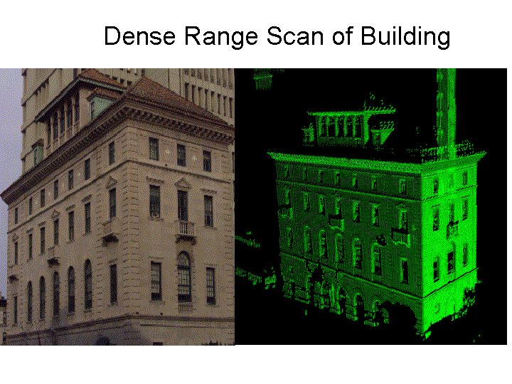
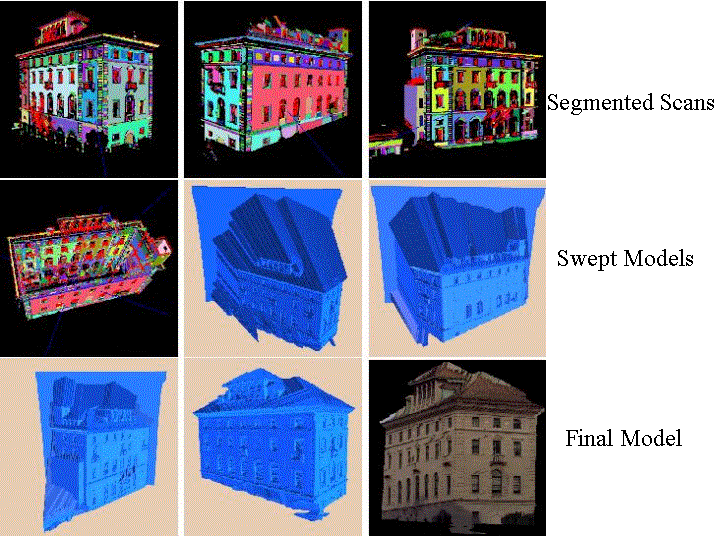
3-D Outdoor modeling, with photometry, for buildings on Columbia Campus. Dense range scans are segmented and registered, and a 3-D solid model is created by volumetric sweep intersection. Texture mapping is then automatically applied to create a geometric and photometric correct model.
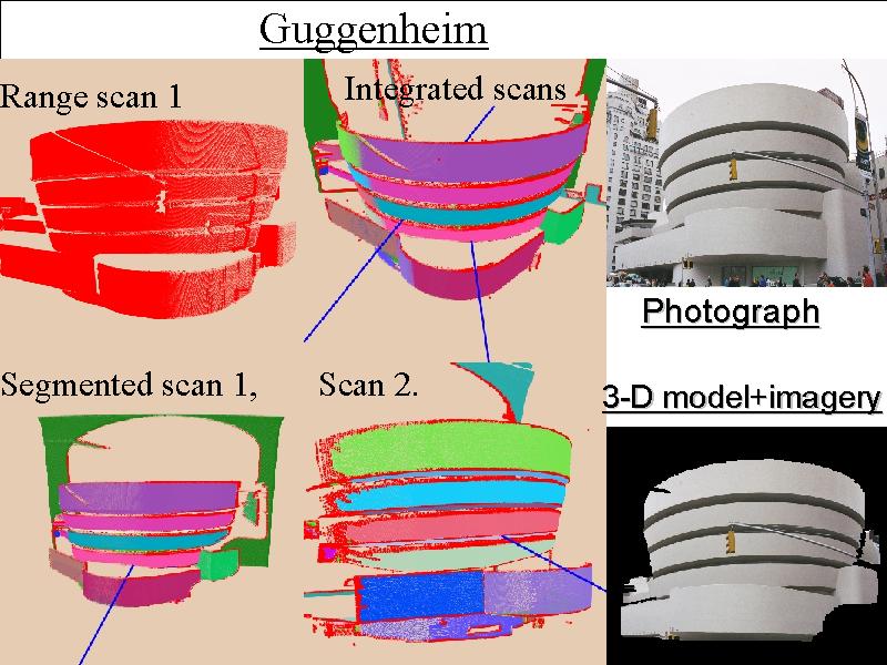
Guggenheim Museum. Two range scans are integrated to create a 3-D model which is then texture mapped.
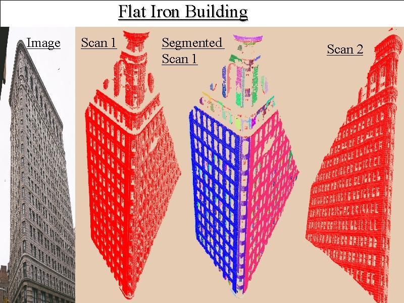
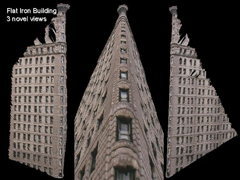 Flatiron Building, NYC. Two range scans are integrated to create a 3-D
model which is then texture mapped.
Flatiron Building, NYC. Two range scans are integrated to create a 3-D
model which is then texture mapped.
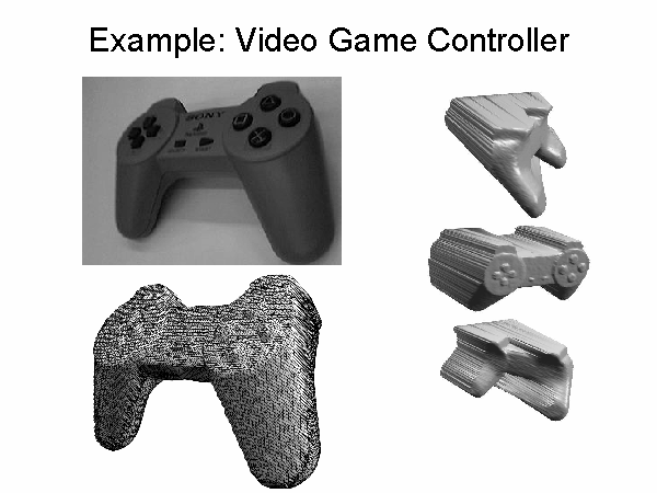
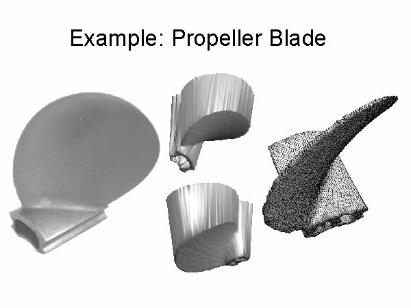
Solid model construction method: Video game controller constructed from 3 range scans via volumetric intersection. Propeller was constructed from 2 180 degree opposite range scans and volume interesction.
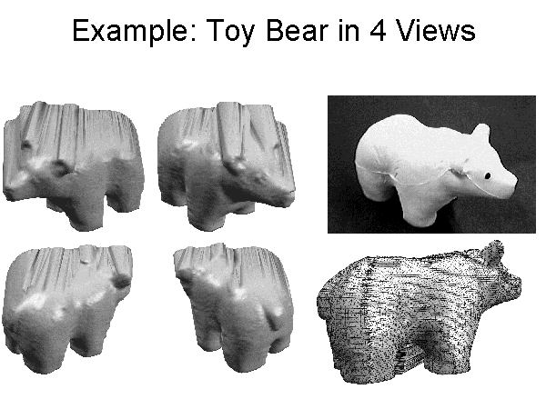
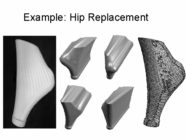
Bear constructed from 4 views, Hip Prothesis from 4 views